Imagine a world where your delivery drone doesn’t just land on your doorstep, but gently places the package on your kitchen counter, avoiding the cat bowl with inch-perfect precision. Envision a self-driving car that navigates a complex, multi-level urban interchange during a torrential downpour with more confidence than a human driver on a sunny day. Picture a future where rescue robots can find survivors buried deep within the rubble of a collapsed building, not by sound or smell, but by creating a perfect, real-time 3D map of the destruction. This is not a scene from a science fiction movie; it is the imminent future being unlocked by a revolutionary navigation technology known as Astradia.
For decades, our global society has been guided by the silent, invisible hand of the Global Positioning System, or GPS. This satellite-based technology has fundamentally reshaped everything from personal travel to global logistics, becoming a utility as essential as electricity or running water. But as our ambitions have grown—as we dream of autonomous vehicle networks, persistent urban air mobility, and hyper-precise industrial automation—the limitations of GPS have become glaringly apparent. It fails in urban canyons, deep indoors, and underground. Its accuracy, while impressive for getting you to a street address, is woefully inadequate for the centimeter-level precision required by next-generation technologies. We have been trying to build a future of autonomy with a navigation tool from the last century. That is, until now. Astradia represents a paradigm shift, a fundamental rethinking of what navigation can be. It is not an incremental improvement on GPS; it is a completely new framework, a system that perceives the world in rich, multidimensional detail, offering a level of accuracy, reliability, and intelligence that was previously unimaginable. This revolutionary navigation technology is poised to become the foundational layer for the next great leap in human technological progress.
What Exactly is Astradia? Beyond the Buzzword
To understand the profound impact of Astradia, we must first move beyond the hype and grasp its core identity. At its heart, Astradia is a sophisticated fusion of several advanced technologies, creating a unified positioning system that is both incredibly precise and contextually aware. While traditional GPS relies on timing signals from a constellation of satellites in Medium Earth Orbit, Astradia operates on a different principle altogether. It creates a dynamic, high-fidelity “digital twin” of its immediate physical environment, constantly updating this model with a flood of data from an array of onboard sensors. These typically include solid-state LiDAR for micrometer-level distance mapping, inertial measurement units (IMUs) for tracking orientation and movement, advanced computer vision algorithms that can recognize and classify objects, and, crucially, a new form of localized transceiver network that acts as a backup and enhancement system, ensuring functionality even when traditional signals are unavailable.
The true genius of Astradia lies not in any single one of these components, but in the AI-powered “brain” that synthesizes them. This is where the magic happens. Where a GPS receiver might give you a coordinate that places you somewhere on a 10-meter-wide road, Astradia’s processing unit fuses the LiDAR point cloud, visual data, and inertial readings to understand not just that you are on the road, but which lane you are in, how your vehicle is oriented, and the precise distance to the curb, the car next to you, and the pedestrian about to step off the sidewalk. It is the difference between looking at a static, two-dimensional paper map and being physically immersed inside a living, breathing, three-dimensional video game simulation of the world. This contextual awareness is what elevates Astradia from a mere positioning tool to a comprehensive situational intelligence platform.
This revolutionary navigation technology is often described as “cognitive navigation” because it doesn’t just calculate a position; it understands its surroundings. The system can differentiate between a stationary object like a fire hydrant and a dynamic one like a bouncing basketball. It can predict trajectories, identify potential hazards, and make intelligent decisions based on a deep, real-time understanding of the environment. This capability is built upon a foundation of machine learning models that have been trained on petabytes of spatial data, allowing the system to recognize patterns, infer intent from the movement of other objects, and navigate complex scenarios with a level of sophistication that mimics, and in some cases surpasses, human spatial reasoning. Astradia is, therefore, not just a new set of eyes for machines; it is a new brain.
The Core Principles Powering Astradia’s Revolutionary Capabilities
The astounding performance of the Astradia system can be distilled into a few core operating principles. These are the fundamental pillars that separate it from all previous navigation technologies and form the bedrock of its revolutionary potential. Understanding these principles is key to appreciating why Astradia is such a disruptive force across so many industries. It is a symphony of advanced concepts working in perfect harmony, each one addressing a critical weakness of the GPS-dominated past.
The first and most critical principle is Multi-Modal Sensor Fusion. GPS is a single-source system; if the satellite signal is blocked or reflected, the system fails or becomes inaccurate. Astradia, in stark contrast, is inherently redundant and synergistic. It continuously ingests data from LiDAR, cameras, IMUs, and other proprietary sensors. Its central processing unit doesn’t just switch between these sources; it blends them together, using the strengths of one to compensate for the weaknesses of another. For example, while LiDAR provides exquisite geometric detail, it can struggle with certain reflective surfaces. The computer vision system can fill in these gaps by recognizing the object visually. Similarly, IMUs can provide ultra-short-term movement data during the brief moments when other sensors might be occluded. This fusion creates a robust and continuous stream of positional data that is far more reliable than any single source could ever be.
The second principle is Real-Time Environmental Modeling. Astradia doesn’t just see dots and lines; it constructs a rich, three-dimensional model of its environment on the fly. As the system moves, its sensors sweep the area, building a dense point cloud that defines the geometry of every surface. Simultaneously, its visual AI classifies these points, labeling them as “road,” “building,” “person,” “vehicle,” “tree,” etc. This process creates a semantically understood world. The system knows it is navigating between two buildings, not just two large obstacles. It knows it is avoiding a human being, not just a moving blob of data. This real-time modeling is computationally intensive, but it is what allows for the proactive, intelligent navigation that defines the Astradia experience. It transforms raw sensor data into actionable, contextual knowledge.
The third foundational principle is Decentralized Network Integrity. While Astradia’s onboard systems are powerful, its true resilience comes from its ability to connect with a localized network of other Astradia units and fixed transceivers. Imagine a fleet of autonomous delivery robots in a city center. Each robot is building its own environmental model. Through the Astradia network, they can share these models, creating a collective, constantly updated “hive mind” map of the area. If one robot encounters a new construction site, it immediately shares this data with the entire network, allowing all other units to preemptively reroute. This decentralized approach means the system gets smarter and more robust with more users, creating a powerful network effect that no isolated GPS unit could ever achieve. This collaborative intelligence is a hallmark of this revolutionary navigation technology.
Astradia vs. GPS: A Quantum Leap in Precision and Reliability
To truly grasp the magnitude of the shift that Astradia represents, a direct comparison with the current global standard, GPS, is essential. The differences are not merely incremental; they are foundational, touching upon every aspect of performance, from basic accuracy to operational reliability in challenging environments. The following table lays out a clear, side-by-side comparison of these two technologies across several critical parameters.
| Feature | Global Positioning System (GPS) | Astradia Navigation Technology |
| Fundamental Principle | Satellite-based radio wave timing | Multi-sensor fusion & real-time environmental modeling |
| Typical Accuracy | 3-5 meters (civilian), ~1 meter (enhanced) | Centimeter to millimeter level |
| Operational Environment | Outdoors, clear sky view required | Any environment: indoors, outdoors, urban canyons, underground |
| Susceptibility to Jamming/Spoofing | High (relies on weak signals from space) | Very Low (uses multiple, localized data sources) |
| Data Output | 2D/3D coordinates (Latitude, Longitude, Altitude) | 4D pose (3D position + orientation) + full 3D environmental model |
| Update Frequency | ~1 Hertz (1 update per second) | 10-100 Hertz (10-100 updates per second) |
As the table illustrates, the gap between the two systems is vast. GPS’s meter-level accuracy, while sufficient for turn-by-turn road navigation, is utterly useless for tasks like robotic surgery, precision agriculture, or docking two spacecraft. Astradia’s centimeter-level precision opens up these possibilities and thousands more. Furthermore, the dependency of GPS on a clear line of sight to satellites is its Achilles’ heel. The moment you enter a building, a tunnel, or even a dense urban area with tall skyscrapers, the signal degrades or disappears entirely. This is the infamous “urban canyon” effect.
“We have been trying to navigate the complex, three-dimensional world of the 21st century with a two-dimensional tool from the 20th. Astradia finally gives our machines the eyes and the brain to see the world as it truly is.” – Dr. Aris Thorne, Chief Architect of the Astradia Project.
This reliance on satellite signals also makes GPS highly vulnerable to intentional interference, both jamming (blocking the signal) and spoofing (sending a false signal to mislead the receiver). These are not just theoretical threats; incidents of GPS spoofing have been reported against ships, aircraft, and even financial trading systems. Astradia’s multi-modal approach makes it inherently resistant to such attacks. To spoof Astradia, an attacker would need to simultaneously spoof its LiDAR, its cameras, its IMU, and its local network—a virtually impossible feat. This resilience is not a bonus feature; it is a core design principle that makes Astradia the only viable choice for safety- and security-critical applications.
Real-World Applications: How Astradia is Reshaping Industries Today
The theoretical advantages of Astradia are compelling, but its true power is revealed in its practical, real-world applications. This revolutionary navigation technology is not a lab-bound prototype; it is already being deployed in pilot programs and early commercial adoptions, demonstrating transformative potential across a stunningly diverse range of sectors. From the depths of the ocean to the aisles of a warehouse, Astradia is proving to be the key that unlocks new levels of efficiency, safety, and capability.
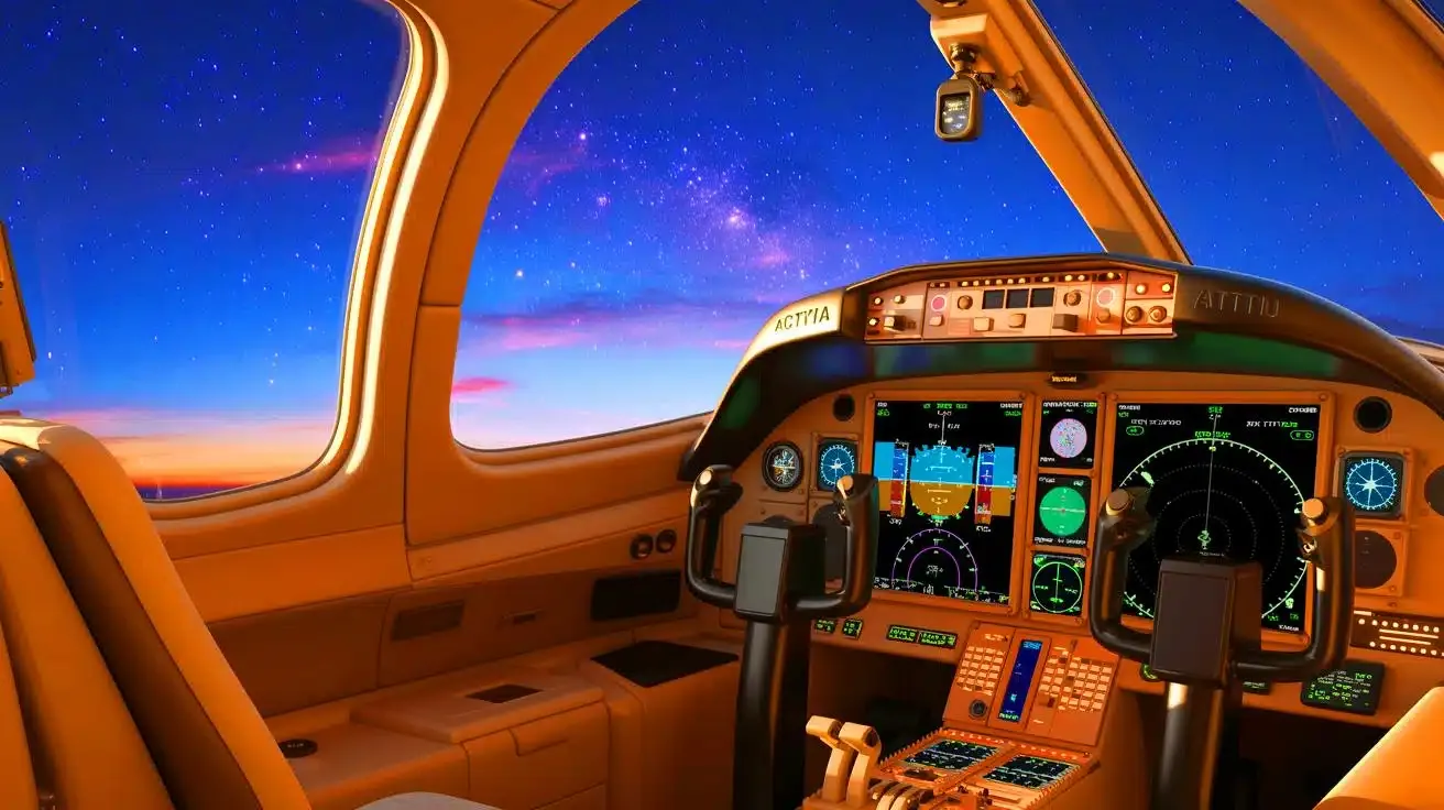
In the realm of Autonomous Vehicles and Urban Air Mobility, Astradia is the enabling technology. Self-driving cars using GPS alone would be hopelessly lost in a multi-story parking garage or a complex tunnel system. With Astradia, the vehicle maintains a perfect, continuous understanding of its location and surroundings. It can navigate tight corners, identify empty parking spots with pinpoint accuracy, and interact seamlessly with other autonomous systems. For the emerging sector of Urban Air Mobility—essentially, flying taxis—the requirements are even more stringent. These aircraft will need to take off and land on small pads in dense urban environments, requiring navigation that is not just accurate, but also incredibly robust and fault-tolerant. Astradia provides the four-dimensional pose (position and orientation) and real-time obstacle avoidance necessary to make this futuristic mode of transport a safe, everyday reality.
The Logistics and Warehouse Automation industry is undergoing a revolution of its own, driven by e-commerce demands, and Astradia is at its core. Modern fulfillment centers are chaotic, dynamic environments where thousands of robots work in concert. Traditional systems that rely on QR codes on the floor or wireless beacons are inflexible and difficult to scale. Robots using Astradia technology can navigate freely, adapting to changing layouts in real-time. They can precisely identify the location of a shelf, maneuver to within millimeters of it, and collaborate with other robots to optimize picking and packing paths. This leads to a dramatic increase in throughput and a drastic reduction in errors. Furthermore, Astradia-equipped drones can perform fully autonomous inventory checks by flying through aisles and scanning shelves, a task that is both dangerous and time-consuming for human workers.
In the field of Healthcare and Surgery, the precision of Astradia is literally life-saving. Robotic-assisted surgery has advanced significantly, but Astradia takes it a step further by providing unparalleled spatial context. Imagine a surgical robot that not only follows the surgeon’s commands but also has a real-time, sub-millimeter model of the patient’s anatomy, allowing it to avoid critical structures like nerves and blood vessels with absolute precision. In rehabilitation, exoskeletons and prosthetics powered by Astradia can provide more natural and stable mobility by understanding the terrain—whether it’s a flat floor, a staircase, or uneven ground—and adjusting their support accordingly. This revolutionary navigation technology is bringing a new level of intelligence and safety to medical robotics.
The applications extend to Agriculture, Construction, and Public Safety. Smart tractors using Astradia can perform ultra-precise planting and fertilizing, reducing waste and environmental impact. In construction, autonomous bulldozers and excavators can execute complex grading plans with centimeter accuracy, guided by a digital blueprint. For search and rescue teams, Astradia-equipped robots can enter collapsed structures, creating a real-time 3D map for responders while precisely tracking their own location deep within the rubble, something GPS could never do. The potential is boundless, limited only by our imagination.
The Technical Architecture of the Astradia System
Peeling back the layers of the Astradia system reveals a marvel of modern engineering, a carefully orchestrated hardware and software stack designed for one purpose: to achieve flawless spatial intelligence. The architecture is built for speed, redundancy, and intelligence, ensuring that the system can perform its complex calculations in real-time, under the most demanding conditions. It is a holistic ecosystem where every component is optimized to play its part in the larger symphony of navigation.
On the Hardware Layer, Astradia integrates a suite of state-of-the-art sensors. The most prominent is the solid-state LiDAR unit, which uses laser beams to create a precise 3D point cloud of the environment without any moving parts, making it more reliable and compact. This is complemented by a stereo or multi-lens camera system that provides high-resolution visual data, which is crucial for color, texture, and object classification. The Inertial Measurement Unit (IMU) is a workhorse sensor, containing accelerometers and gyroscopes that track the system’s velocity, orientation, and gravitational forces at a very high frequency, filling in the gaps between LiDAR and camera updates. Finally, a proprietary Astradia Transceiver allows for short-range, high-bandwidth communication with other units and fixed nodes in the local network, enabling the shared environmental model.
The Software and Processing Layer is where the raw data is transformed into wisdom. This is dominated by a powerful AI inference engine running sophisticated machine learning models for Simultaneous Localization and Mapping (SLAM) and computer vision. The SLAM algorithms are the core of the system’s ability to build a map of an unknown environment while simultaneously tracking its location within it. The computer vision models are trained on massive datasets to recognize and classify millions of objects—from a pedestrian to a traffic cone to a specific piece of industrial machinery. All this data is fed into a sensor fusion engine, a complex piece of software (often based on Bayesian filters or neural networks) that weighs the inputs from all sensors, resolves contradictions, and outputs a single, best-estimate of the system’s “pose” and a refined model of the environment. This entire process happens in a fraction of a second, over and over again, creating the fluid, real-time responsiveness that defines the Astradia experience.
The Future Trajectory: What’s Next for Astradia and Global Navigation?
The development of Astradia is not a destination but a journey. The current technology, as impressive as it is, represents only the first step on a long and exciting roadmap. The future trajectory of this revolutionary navigation technology points towards even greater integration, intelligence, and ubiquity. Researchers and developers are already working on the next wave of innovations that will build upon the Astradia foundation, pushing the boundaries of what is possible in autonomous interaction.
One of the most anticipated advancements is the move towards Standardization and Global Infrastructure. For Astradia to reach its full potential, it cannot remain a proprietary system used in isolated applications. The future likely holds the development of open standards and protocols, allowing Astradia units from different manufacturers to communicate and collaborate seamlessly. This would lead to the creation of a global “Astradia Net,” a decentralized network of fixed transceivers in cities, along highways, and inside major buildings, providing a universal high-precision positioning backbone. This infrastructure would be as fundamental to the 22nd century as the electrical grid was to the 20th, powering everything from personal devices to national defense systems.
Another critical frontier is the development of Predictive Navigation and Swarm Intelligence. Current Astradia systems are brilliant at understanding the present state of the world. The next generation will be able to predict the future. By incorporating more advanced AI and access to broader data streams (like city-wide traffic flow patterns or weather systems), Astradia will be able to forecast the movements of other dynamic agents. An autonomous car won’t just see a pedestrian; it will analyze their gait and trajectory to predict if they are likely to step into the street, allowing for smoother, earlier, and safer avoidance maneuvers. Furthermore, swarm intelligence will allow large groups of Astradia-equipped agents—like a hundred delivery drones—to coordinate their movements as a single, intelligent organism, optimizing routes and avoiding collisions in a beautifully complex aerial ballet.
Finally, we can expect a push towards Miniaturization and Power Efficiency. The current sensor suites, while advanced, can be bulky and power-hungry. Future research will focus on shrinking these components, perhaps integrating LiDAR and other sensors directly into semiconductor chips, dramatically reducing their size, cost, and energy consumption. This will open the door for Astradia to be incorporated into consumer electronics like smartphones and augmented reality glasses, as well as into smaller, more numerous Internet of Things (IoT) devices. Imagine your phone guiding you through a museum with pinpoint accuracy, highlighting artifacts right in your field of view, or a tiny environmental monitor robot that can navigate the intricate ductwork of a building. The miniaturization of Astradia will weave this revolutionary navigation technology into the very fabric of our daily lives.
Addressing the Challenges: Security, Privacy, and Accessibility
No discussion of a technology as powerful and pervasive as Astradia would be complete without a sober examination of the challenges it presents. The very capabilities that make it so transformative—its precision, its persistent environmental modeling, its network connectivity—also raise important questions about security, data privacy, and equitable access. Proactively addressing these concerns is not an option; it is a prerequisite for the responsible and successful deployment of this revolutionary navigation technology.
The Security and Cyber-Physical Threat landscape for a system like Astradia is complex. While its multi-modal nature makes it inherently harder to spoof than GPS, it is not invulnerable. A sophisticated attacker might attempt to deceive the AI’s computer vision system with adversarial attacks—specially crafted patterns or images that fool the object classification model. They might also try to jam the local transceiver network or compromise the data shared between units. A successful attack could have catastrophic consequences, from causing traffic accidents to disrupting entire supply chains. Therefore, the Astradia architecture is being developed with “security-by-design” principles. This includes robust encryption for all data communications, continuous integrity checks of the sensor data, and anomaly detection systems that can identify and isolate potentially compromised units within the network.
The Data Privacy and Ethical Considerations are equally paramount. Astradia systems, by their very function, are constant and meticulous data collection devices. The high-resolution 3D maps they create could include detailed imagery of private property, public spaces, and individuals. Who owns this data? How is it stored, processed, and used? Could it be used for pervasive mass surveillance? The developers of Astradia are advocating for a strict ethical framework that includes data anonymization techniques, on-device processing for sensitive information (so raw data never leaves the device), and clear, transparent user consent protocols. The goal is to build a system that is intelligent and aware, but not intrusive or Orwellian.
Finally, there is the critical issue of Accessibility and the Global Divide. A high-tech system like Astradia carries a significant cost, both for the hardware and the supporting infrastructure. There is a genuine risk that it could become a technology only available to wealthy nations, corporations, and individuals, thereby exacerbating the global digital divide. To prevent this, initiatives are already underway to develop low-cost, simplified versions of the technology for developing economies and for public benefit applications. The long-term vision is to make the core benefits of Astradia—safer transportation, more efficient logistics, better disaster response—accessible to all of humanity, not just a privileged few. Navigating these social and ethical challenges is just as important as perfecting the technology itself.
Conclusion
The journey of navigation technology has been a long and remarkable one, from the stars that guided ancient mariners to the satellites that guide us today. Each leap forward has unlocked new horizons of human endeavor. Now, we stand at the precipice of the next great leap. Astradia is more than just a new tool; it is a fundamental shift in our relationship with the physical world. It offers a vision of a future where machines can move through our complex human environments with a grace, precision, and intelligence that we once only dreamed of. This revolutionary navigation technology is the key that will unlock the era of true autonomy, transforming everything from how we receive a package to how we save lives in a disaster. The age of guessing our position is coming to a close. The age of knowing, with absolute certainty, is dawning. The future of navigation is not just about knowing where you are; it’s about understanding everything around you. The future is Astradia.
Frequently Asked Questions About Astradia
What makes Astradia a “revolutionary” navigation technology compared to what we have now?
Astradia is considered revolutionary because it represents a complete paradigm shift from satellite-dependent systems like GPS. Instead of relying on a single type of signal from space, Astradia uses a fusion of multiple advanced sensors—LiDAR, cameras, inertial units—to create a real-time, three-dimensional model of its immediate environment. This allows for centimeter-level precision, operational capability indoors and outdoors, and a level of contextual awareness (knowing what objects are, not just where they are) that GPS cannot possibly achieve. It’s the difference between seeing the world as a flat map and being immersed in a live, interactive 3D simulation.
Is Astradia meant to completely replace GPS?
Not in the immediate future, and likely not entirely. In the near term, Astradia and GPS are best seen as complementary technologies. GPS is excellent for providing a rough, global position fix over wide areas with minimal infrastructure. Astradia is unparalleled for precise, local navigation in complex environments. A likely scenario is that a device would use GPS for initial, coarse positioning and then hand over to the Astradia system for fine-grained, local navigation—like a car using GPS to get to a neighborhood and then using Astradia to navigate the streets and drive itself into a tight parking spot. Over the long term, as the Astradia network infrastructure grows, its dependency on GPS will diminish.
How does the Astradia system handle poor weather conditions like heavy rain or fog?
This is a key challenge for any sensor-based system, and Astradia is designed with robustness in mind. Poor visibility can indeed affect camera and LiDAR performance. However, the system’s multi-sensor fusion is its greatest defense. While LiDAR might be scattered by dense fog and cameras obscured by heavy rain, the inertial measurement units (IMUs) and the local transceiver network are largely unaffected. The AI brain of Astradia is trained to recognize these conditions and weigh the sensor inputs accordingly, relying more heavily on the IMUs and the shared data from the network to maintain a reliable position estimate. It’s not perfect, but it is exponentially more resilient than a vision-only system or GPS alone.
Will Astradia technology be affordable for everyday consumers and small businesses?
The initial applications of Astradia are in high-value industries like autonomous vehicles and advanced robotics, where the cost of the sensor suite is justified by the capabilities it enables. However, like all transformative technologies, the cost is expected to fall rapidly through economies of scale and technological miniaturization. We’ve seen this pattern with GPS, LiDAR, and digital cameras. The industry is actively working on developing smaller, cheaper, and more power-efficient versions of the core components. Within a decade, we can expect to see Astradia-level navigation integrated into mainstream consumer products like smartphones, drones, and smart home devices, making it accessible to everyone.
What are the biggest hurdles Astradia needs to overcome for widespread adoption?
The three primary hurdles are cost, standardization, and public trust. As mentioned, cost is a current barrier, but one that is being actively addressed. Standardization is crucial; for a seamless experience, all Astradia devices need to be able to “speak the same language” and share data securely. Finally, building public trust is paramount. This involves rigorously proving the system’s safety and reliability through billions of miles of real-world testing, and also establishing clear and ethical guidelines for data privacy, ensuring that the powerful mapping capabilities of Astradia are not misused for surveillance. Overcoming these hurdles is a collaborative effort between engineers, corporations, and regulators.